
Rishtan topographic map
Interactive map
Click on the map to display elevation.
Rishtan
Rishton (Uzbek: Rishton, Tajik: Рештон, Russian: Риштан, alternative spellings Rishtan, Rishdan, Roshidon, previously called also Kyubishev by Russians) is a city in Fergana Region, in Uzbekistan. It is the administrative center of Rishton District. Its population is 34,800 (2016). It is located about halfway between Kokand and Fergana at latitude 40°21'24N longitude 71°17'5E, and at an elevation of 471 meters.
About this map
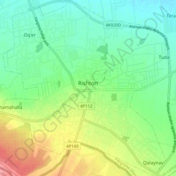
Name: Rishtan topographic map, elevation, terrain.
Location: Rishtan, Rishton Tumani, Fergana Region, 151300, Uzbekistan (40.33335 71.24432 40.38713 71.31145)
Average elevation: 473 m
Minimum elevation: 441 m
Maximum elevation: 536 m