
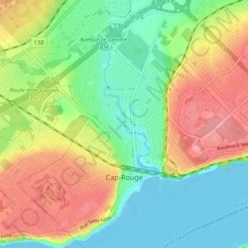
Cap-Rouge topographic map
Interactive map
Click on the map to display elevation.
About this map
Name: Cap-Rouge topographic map, elevation, terrain.
Average elevation: 39 m
Minimum elevation: -5 m
Maximum elevation: 92 m
Other topographic maps
Click on a map to view its topography, its elevation and its terrain.
Saint-Émile
Canada > Québec > Agglomération de Québec > Québec
Saint-Émile, La Haute-Saint-Charles, Québec, Agglomération de Québec, Capitale-Nationale, Québec, Canada
Average elevation: 157 m