
Gosende topographic map
Interactive map
Click on the map to display elevation.
About this map
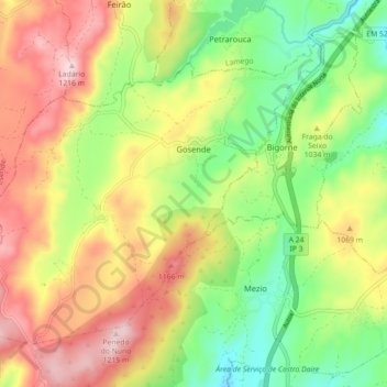
Name: Gosende topographic map, elevation, terrain.
Location: Gosende, Castro Daire, Viseu, Portugal (40.97446 -7.96542 41.02662 -7.87651)
Average elevation: 1,011 m
Minimum elevation: 839 m
Maximum elevation: 1,210 m
Other topographic maps
Click on a map to view its topography, its elevation and its terrain.