
Mayo-Tsanaga topographic map
Interactive map
Click on the map to display elevation.
About this map
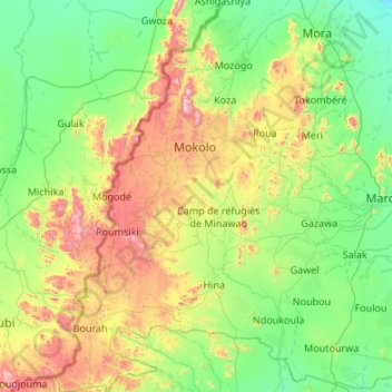
Name: Mayo-Tsanaga topographic map, elevation, terrain.
Location: Mayo-Tsanaga, Extrême-Nord, Cameroun (10.07982 13.41220 11.13692 14.09285)
Average elevation: 585 m
Minimum elevation: 319 m
Maximum elevation: 1,441 m
Other topographic maps
Click on a map to view its topography, its elevation and its terrain.