Le Pont d'Arc topographic map
Interactive map
Click on the map to display elevation.
About this map
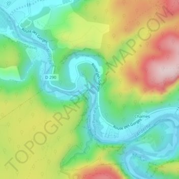
Name: Le Pont d'Arc topographic map, elevation, terrain.
Average elevation: 205 m
Minimum elevation: 69 m
Maximum elevation: 427 m

Click on the map to display elevation.
Name: Le Pont d'Arc topographic map, elevation, terrain.
Average elevation: 205 m
Minimum elevation: 69 m
Maximum elevation: 427 m