
Thank you for supporting this site ❤️
Make a donation
Make a donation
Gear up for your next adventure:
As an Amazon Associate, this site earns from qualifying purchases at no extra cost to you.
Janakipuram topographic map
Click on the map to display elevation.
Thank you for supporting this site ❤️
Make a donation
Make a donation
Gear up for your next adventure:
As an Amazon Associate, this site earns from qualifying purchases at no extra cost to you.
About this map
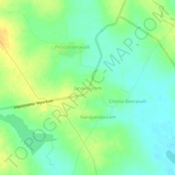
Name: Janakipuram topographic map, elevation, terrain.
Location: Janakipuram, Bonakal mandal, Khammam, Telangana, 507204, India (17.02304 80.29060 17.06304 80.33060)
Average elevation: 78 m
Minimum elevation: 65 m
Maximum elevation: 94 m
Thank you for supporting this site ❤️
Make a donation
Make a donation
Gear up for your next adventure:
As an Amazon Associate, this site earns from qualifying purchases at no extra cost to you.