
Dawson County topographic map
Interactive map
Click on the map to display elevation.
About this map
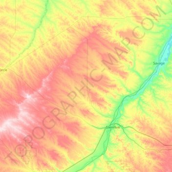
Name: Dawson County topographic map, elevation, terrain.
Location: Dawson County, Montana, USA (46.85975 -105.40639 47.79110 -104.30581)
Average elevation: 778 m
Minimum elevation: 584 m
Maximum elevation: 1,069 m
Other topographic maps
Click on a map to view its topography, its elevation and its terrain.