
Sękowo topographic map
Interactive map
Click on the map to display elevation.
About this map
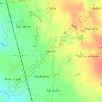
Name: Sękowo topographic map, elevation, terrain.
Average elevation: 128 m
Minimum elevation: 107 m
Maximum elevation: 150 m
Other topographic maps
Click on a map to view its topography, its elevation and its terrain.
Włóki
Poland > Masovian Voivodeship > Płock County
Włóki, gmina Bulkowo, Płock County, Masovian Voivodeship, 09-454, Poland
Average elevation: 129 m
Trzebuń
Poland > Masovian Voivodeship > Płock County > Trzebuń
Trzebuń, gmina Stara Biała, Płock County, Masovian Voivodeship, Poland
Average elevation: 119 m
Małachowo
Poland > Masovian Voivodeship > Płock County > Małachowo
Małachowo, gmina Drobin, Płock County, Masovian Voivodeship, 09-210, Poland
Average elevation: 136 m
Płock
Poland > Masovian Voivodeship > Płock County
Płock, Płock County, Masovian Voivodeship, Poland
Average elevation: 87 m