
Maungaraki topographic map
Interactive map
Click on the map to display elevation.
About this map
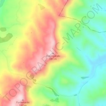
Name: Maungaraki topographic map, elevation, terrain.
Location: Maungaraki, Carterton District, Wellington, New Zealand (-41.09315 175.73691 -41.09305 175.73701)
Average elevation: 357 m
Minimum elevation: 211 m
Maximum elevation: 530 m
Other topographic maps
Click on a map to view its topography, its elevation and its terrain.
Carterton
New Zealand > Wellington > Carterton District
Carterton, Carterton District, Wellington, 5713, New Zealand
Average elevation: 82 m