
Illa Roja topographic map
Interactive map
Click on the map to display elevation.
About this map
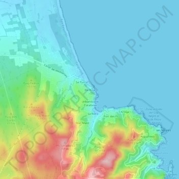
Name: Illa Roja topographic map, elevation, terrain.
Location: Illa Roja, Begur, Baix Empordà, Gerona, Catalonië, 17213, Spanje (41.95790 3.18879 41.99790 3.22879)
Average elevation: 49 m
Minimum elevation: -3 m
Maximum elevation: 211 m