
Bolec topographic map
Interactive map
Click on the map to display elevation.
About this map
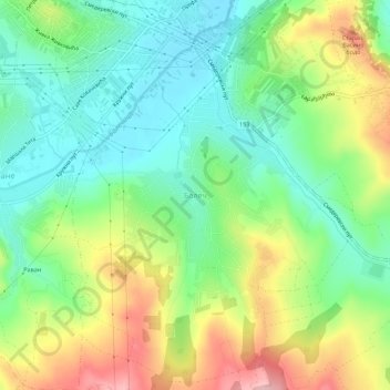
Name: Bolec topographic map, elevation, terrain.
Average elevation: 142 m
Minimum elevation: 76 m
Maximum elevation: 252 m
Other topographic maps
Click on a map to view its topography, its elevation and its terrain.
Grocka Urban Municipality
Serbia > Central Serbia > City of Belgrade > Grocka Urban Municipality
Average elevation: 146 m