
Torrent topographic map
Interactive map
Click on the map to display elevation.
About this map
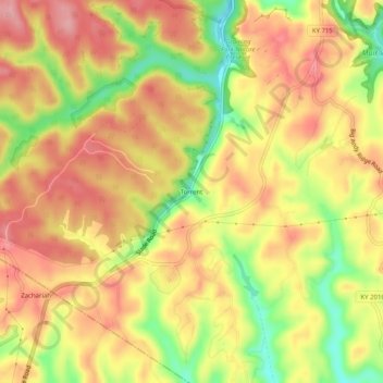
Name: Torrent topographic map, elevation, terrain.
Location: Torrent, Wolfe County, Kentucky, 41303, United States (37.69592 -83.68297 37.73592 -83.64297)
Average elevation: 345 m
Minimum elevation: 267 m
Maximum elevation: 397 m
Other topographic maps
Click on a map to view its topography, its elevation and its terrain.
Mary
United States > Kentucky > Wolfe County
Mary, Wolfe County, Kentucky, 41301, United States
Average elevation: 299 m
Campton
United States > Kentucky > Wolfe County
Campton, Wolfe County, Kentucky, 41303, United States
Average elevation: 323 m