
Palumbanes Islands topographic map
Interactive map
Click on the map to display elevation.
About this map
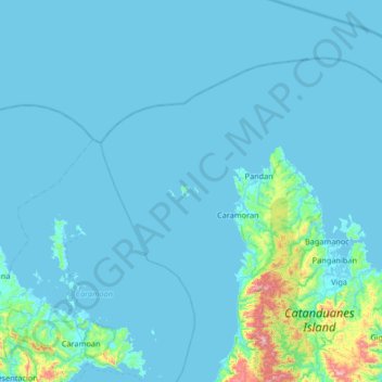
Name: Palumbanes Islands topographic map, elevation, terrain.
Location: Palumbanes Islands, Catanduanes, Región de Bicol, Filipinas (13.70312 123.73354 14.34312 124.37354)
Average elevation: 46 m
Minimum elevation: -2 m
Maximum elevation: 782 m
Other topographic maps
Click on a map to view its topography, its elevation and its terrain.