Geolocate

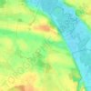
18337 topographic map

Click on the map to display elevation.

About this map

Name: 18337 topographic map, elevation, terrain.

Location: 18337, Marlow, Vorpommern-Rügen, Mecklenburg-Vorpommern, Germany (54.10475 12.35158 54.23149 12.64271)

Average elevation: 28 m

Minimum elevation: -3 m

Maximum elevation: 61 m

Other topographic maps

Click on a map to view its topography, its elevation and its terrain.
Gear up for your next adventure:

🧺Mesh Stuff Sacks - Breathable storage for wet gear or camp organization
🥤Hiking Water Bottles - Reusable bottles for hydration on the trail
📦Compression Sacks - Reduce backpack volume efficiently
👖Convertible Hiking Trousers - Versatile zip-off pants for changing mountain weather conditions
📕Outdoor Navigation Books - Learn traditional and modern navigation techniques

As an Amazon Associate, this site earns from qualifying purchases at no extra cost to you.