Geolocate

Ranier topographic map

Click on the map to display elevation.

About this map
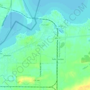
Name: Ranier topographic map, elevation, terrain.

Location: Ranier, Koochiching County, Minnesota, 56668, United States (48.59619 -93.37246 48.61761 -93.33944)

Average elevation: 342 m

Minimum elevation: 334 m

Maximum elevation: 358 m

Other topographic maps

Click on a map to view its topography, its elevation and its terrain.

Nakoda

United States > Minnesota > Koochiching County

Average elevation: 351 m

Margie

United States > Minnesota > Koochiching County

Average elevation: 382 m

Gear up for your next adventure:

🕶️Glacier Goggles - Maximum protection for high-altitude snow topography
📱Rugged Phone Cases - Heavy-duty protection for smartphones used as secondary GPS tools
🥤Collapsible Water Bottles - Save space in your rucksack as you consume your water
🧥Waterproof Hiking Jackets - Rain protection for walking in all weather conditions
🛑Emergency Bivvy Bags - Heat-reflective survival bags for unexpected nights out

As an Amazon Associate, this site earns from qualifying purchases at no extra cost to you.