Geolocate

Tönning topographic map

Click on the map to display elevation.

About this map
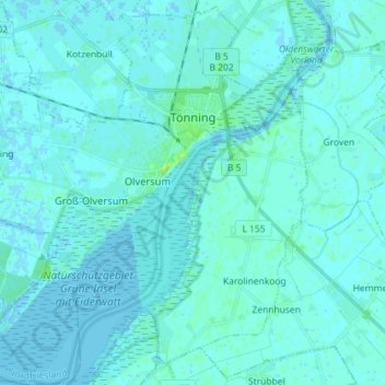
Name: Tönning topographic map, elevation, terrain.

Location: Tönning, Northern Friesland, Schleswig-Holstein, 25832, Germany (54.26060 8.82231 54.34420 8.96542)

Average elevation: 2 m

Minimum elevation: -3 m

Maximum elevation: 12 m

Other topographic maps

Click on a map to view its topography, its elevation and its terrain.

Gear up for your next adventure:

🎒Hiking Backpacks - Comfortable backpacks for day hikes and multi-day treks
🥤Hiking Water Bottles - Reusable bottles for hydration on the trail
🧺Ultralight Dry Bags - Organize and waterproof your gear inside your rucksack
🥾Women's Waterproof Hiking Boots - High-performance trekking boots designed for all-weather comfort
🧦Hiking Socks - Breathable socks designed to prevent blisters on long walks

As an Amazon Associate, this site earns from qualifying purchases at no extra cost to you.