
Thank you for supporting this site ❤️
Make a donation
Make a donation
Gear up for your next adventure:
As an Amazon Associate, this site earns from qualifying purchases at no extra cost to you.
Lucmacucho topographic map
Click on the map to display elevation.
Thank you for supporting this site ❤️
Make a donation
Make a donation
Gear up for your next adventure:
As an Amazon Associate, this site earns from qualifying purchases at no extra cost to you.
About this map
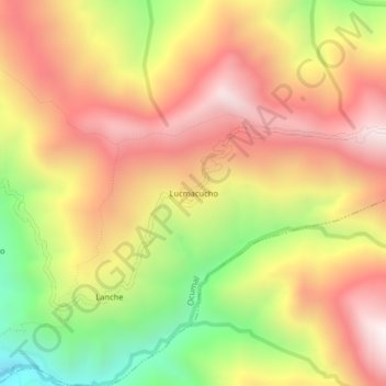
Name: Lucmacucho topographic map, elevation, terrain.
Location: Lucmacucho, Ocumal, Luya, Amazonas, Perú (-6.39723 -78.10332 -6.35723 -78.06332)
Average elevation: 2,630 m
Minimum elevation: 1,913 m
Maximum elevation: 3,198 m
Thank you for supporting this site ❤️
Make a donation
Make a donation
Gear up for your next adventure:
As an Amazon Associate, this site earns from qualifying purchases at no extra cost to you.