Geolocate

Saxe topographic map

Click on the map to display elevation.

About this map

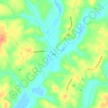
Name: Saxe topographic map, elevation, terrain.

Location: Saxe, Charlotte County, Virginia, 23962, United States (36.90987 -78.68334 36.94987 -78.64334)

Average elevation: 117 m

Minimum elevation: 97 m

Maximum elevation: 144 m

Other topographic maps

Click on a map to view its topography, its elevation and its terrain.

Keysville

United States > Virginia > Charlotte County

Average elevation: 187 m

Phenix

United States > Virginia > Charlotte County

Average elevation: 133 m

Gear up for your next adventure:

🎒Hiking Backpacks - Comfortable backpacks for day hikes and multi-day treks
🚶Walking Pedometers - Simple distance tracking for casual trail walkers
🔦LED Camping Lanterns - Illumination for reading maps inside your tent at night
🥾Women's Waterproof Hiking Boots - High-performance trekking boots designed for all-weather comfort
🔋Power Banks - Portable chargers for long outdoor trips

As an Amazon Associate, this site earns from qualifying purchases at no extra cost to you.