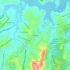
Lourdes topographic map
Click on the map to display elevation.
About this map

Name: Lourdes topographic map, elevation, terrain.
Average elevation: 892 m
Minimum elevation: 833 m
Maximum elevation: 1,007 m
Other topographic maps
Click on a map to view its topography, its elevation and its terrain.


Parque Roberto Burle Marx (Parque das Águas)
Brasil > Minas Gerais > Belo Horizonte > Barreiro
Average elevation: 1,022 m

Ribeirão Arrudas
Brasil > Minas Gerais > Belo Horizonte > Cidade Industrial Coronel Juventino Dias > Glalijá
Average elevation: 914 m