
Merikit Centre topographic map
Interactive map
Click on the map to display elevation.
About this map
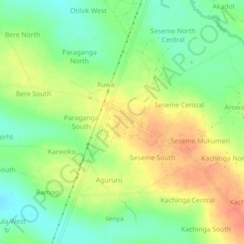
Name: Merikit Centre topographic map, elevation, terrain.
Location: Merikit Centre, Tororo, Eastern Region, Uganda (0.82289 34.08427 0.86289 34.12427)
Average elevation: 1,119 m
Minimum elevation: 1,096 m
Maximum elevation: 1,143 m