
Bonor topographic map
Interactive map
Click on the map to display elevation.
About this map
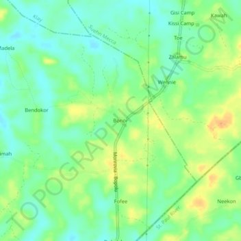
Name: Bonor topographic map, elevation, terrain.
Location: Bonor, Dowein, Bomi County, Liberia (6.54195 -10.76016 6.58195 -10.72016)
Average elevation: 30 m
Minimum elevation: 16 m
Maximum elevation: 47 m