
Chevrette topographic map
Interactive map
Click on the map to display elevation.
About this map
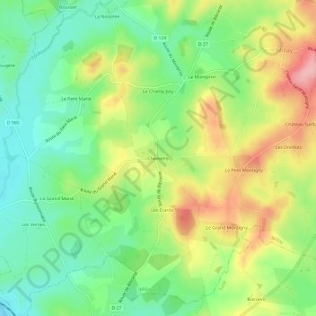
Name: Chevrette topographic map, elevation, terrain.
Average elevation: 313 m
Minimum elevation: 256 m
Maximum elevation: 394 m
Other topographic maps
Click on a map to view its topography, its elevation and its terrain.
Bois de Velle
France > Bourgogne-Franche-Comté > Nièvre > Millay > Bois de Velle
Bois de Velle, Millay, Château-Chinon (Ville), Nièvre, Bourgogne-Franche-Comté, France métropolitaine, 58170, France
Average elevation: 376 m