
Kamwenge topographic map
Interactive map
Click on the map to display elevation.
About this map
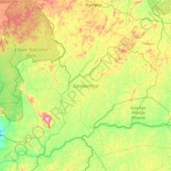
Name: Kamwenge topographic map, elevation, terrain.
Location: Kamwenge, Western Region, Uganda (0.09745 30.28388 0.57681 30.85961)
Average elevation: 1,287 m
Minimum elevation: 1,031 m
Maximum elevation: 1,814 m
Other topographic maps
Click on a map to view its topography, its elevation and its terrain.