Geolocate

Baudour topographic map

Click on the map to display elevation.

About this map

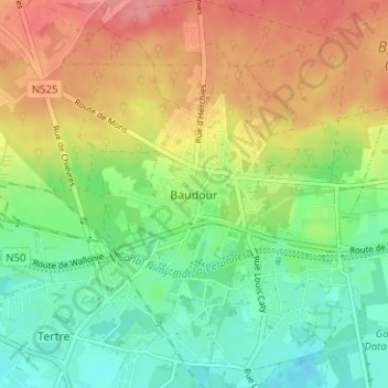
Name: Baudour topographic map, elevation, terrain.

Location: Baudour, Saint-Ghislain, Mons, Hainaut, Wallonia, 7331, Belgium (50.46153 3.81122 50.50153 3.85122)

Average elevation: 53 m

Minimum elevation: 16 m

Maximum elevation: 99 m

Gear up for your next adventure:

📦Dry Bags - Waterproof bags to protect gear from rain
🔥Reusable Hand Warmers - Maintain dexterity in your fingers for precise map handling
🥤Hiking Water Bottles - Reusable bottles for hydration on the trail
💧Hydration Reservoirs - Convenient water bladders for hands-free drinking on the move
🎒Hiking Backpacks - Comfortable backpacks for day hikes and multi-day treks

As an Amazon Associate, this site earns from qualifying purchases at no extra cost to you.