
Cozad topographic map
Interactive map
Click on the map to display elevation.
About this map
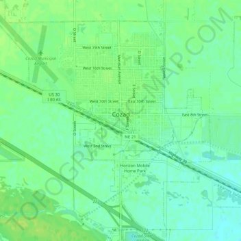
Name: Cozad topographic map, elevation, terrain.
Location: Cozad, Dawson County, Nebraska, 69130, United States (40.83969 -100.01451 40.87740 -99.96718)
Average elevation: 760 m
Minimum elevation: 752 m
Maximum elevation: 767 m