
El Misti topographic map
Click on the map to display elevation.
About this map
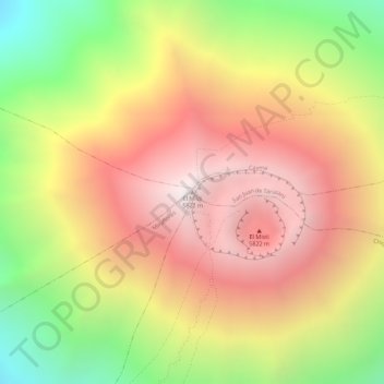
Name: El Misti topographic map, elevation, terrain.
Location: El Misti, Chiguata, Province of Arequipa, Arequipa, Peru (-16.29653 -71.41070 -16.29643 -71.41060)
Average elevation: 5,266 m
Minimum elevation: 4,507 m
Maximum elevation: 5,821 m