
堰塘湾 topographic map
Interactive map
Click on the map to display elevation.
About this map
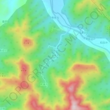
Name: 堰塘湾 topographic map, elevation, terrain.
Location: 堰塘湾, Pingdingshan, Henan, China (33.17140 113.57148 33.21140 113.61148)
Average elevation: 341 m
Minimum elevation: 158 m
Maximum elevation: 674 m
Other topographic maps
Click on a map to view its topography, its elevation and its terrain.