
Río Tumbes topographic map
Interactive map
Click on the map to display elevation.
About this map
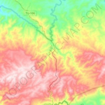
Name: Río Tumbes topographic map, elevation, terrain.
Location: Río Tumbes, Matapalo, Distrito de Tumbes, Tumbes, Perú (-3.90223 -80.30500 -3.77257 -80.25253)
Average elevation: 536 m
Minimum elevation: 170 m
Maximum elevation: 867 m