
Saint Vrain State Park topographic map
Interactive map
Click on the map to display elevation.
Saint Vrain State Park
The land of St. Vrain State Park was originally home to Ute, Arapaho, and Cheyenne Native American tribes. Once claimed by Spain then France who sold it to the United States in 1803 as part of the Louisiana Purchase. Having just made the largest land purchase in the history of the nation, the government was eager to discover what $15,000,000 had bought. They sent out scouts, Meriwether Lewis and William Clark, then Army Lieutenant Zebulon Pike to explore. Although neither group traveled in the area, their descriptions of the land and a growing fur trade encouraged adventurers to head west. In 1817, the US War Department sent Stephen Long, a Major in the Topographical Engineers, to explore the upper Mississippi. Following the North and South Platte Rivers, Long likely saw the St. Vrain Valley in July 1820.
About this map
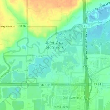
Name: Saint Vrain State Park topographic map, elevation, terrain.
Average elevation: 1,480 m
Minimum elevation: 1,467 m
Maximum elevation: 1,501 m