Geolocate

Linga topographic map

Click on the map to display elevation.

About this map

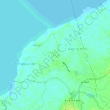
Name: Linga topographic map, elevation, terrain.

Location: Linga, Pila, Laguna, Calabarzon, 4010, Philippines (14.23495 121.33936 14.27495 121.37936)

Average elevation: 4 m

Minimum elevation: -5 m

Maximum elevation: 13 m

Gear up for your next adventure:

📷Camera Straps - Secure straps for carrying cameras while walking
🔪Outdoor Multi-Tools - Versatile tools for gear repairs and food prep in the wild
🧤Waterproof Overmitts - Extreme weather protection for hikers and mountaineers
🔦Outdoor Torches - Reliable torches for night navigation
🥾Trekking Poles - Poles to improve stability on uneven terrain

As an Amazon Associate, this site earns from qualifying purchases at no extra cost to you.