
Ipala topographic map
Interactive map
Click on the map to display elevation.
About this map
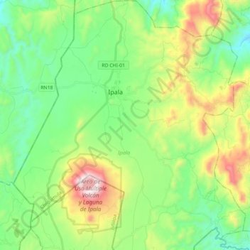
Name: Ipala topographic map, elevation, terrain.
Location: Ipala, Chiquimula, 20011, Guatemala (14.51144 -89.69399 14.68359 -89.52835)
Average elevation: 910 m
Minimum elevation: 575 m
Maximum elevation: 1,626 m
Other topographic maps
Click on a map to view its topography, its elevation and its terrain.