
Wakaya Island topographic map
Interactive map
Click on the map to display elevation.
About this map
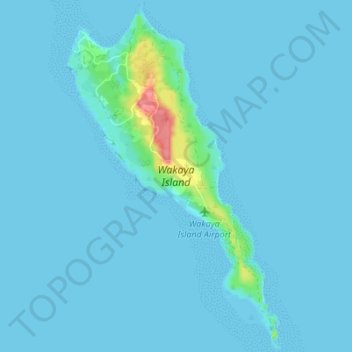
Name: Wakaya Island topographic map, elevation, terrain.
Location: Wakaya Island, Lomaiviti, Eastern, Fiji (-17.65470 178.98219 -17.58913 179.02439)
Average elevation: 5 m
Minimum elevation: -15 m
Maximum elevation: 77 m
Other topographic maps
Click on a map to view its topography, its elevation and its terrain.