
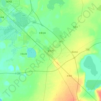
安达市 topographic map
Interactive map
Click on the map to display elevation.
About this map
Name: 安达市 topographic map, elevation, terrain.
Location: 安达市, 新兴街道办事处, 安达市, 绥化市, 黑龙江省, 中国 (46.25143 125.16856 46.57143 125.48856)
Average elevation: 150 m
Minimum elevation: 139 m
Maximum elevation: 176 m
Other topographic maps
Click on a map to view its topography, its elevation and its terrain.