Geolocate

Haruna topographic map

Click on the map to display elevation.

About this map

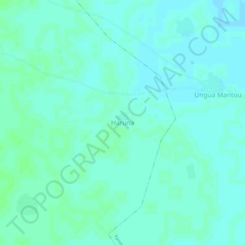
Name: Haruna topographic map, elevation, terrain.

Location: Haruna, Unguwar Rai, Baure, Katsina State, Nigeria (12.69651 8.83852 12.73651 8.87852)

Average elevation: 390 m

Minimum elevation: 387 m

Maximum elevation: 393 m

Gear up for your next adventure:

🚶Walking Pedometers - Simple distance tracking for casual trail walkers
🕶️Glacier Goggles - Maximum protection for high-altitude snow topography
🔦Keychain LED Torches - Emergency backup light for finding gear in your pack
🔋Solar Chargers - Eco-friendly charging solutions for outdoor use
🧥Waterproof Hiking Jackets - Rain protection for walking in all weather conditions

As an Amazon Associate, this site earns from qualifying purchases at no extra cost to you.