Geolocate

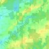
Conneaut topographic map

Click on the map to display elevation.

About this map

Name: Conneaut topographic map, elevation, terrain.

Location: Conneaut, Ashtabula County, Ohio, 44030, United States (41.89198 -80.62927 41.97722 -80.51931)

Average elevation: 212 m

Minimum elevation: 170 m

Maximum elevation: 286 m

Other topographic maps

Click on a map to view its topography, its elevation and its terrain.
Pierpont

United States > Ohio > Ashtabula County

Average elevation: 305 m

Chapel

United States > Ohio > Ashtabula County

Average elevation: 258 m

Phelps Creek

United States > Ohio > Ashtabula County

Average elevation: 326 m

Pierpont

United States > Ohio > Ashtabula County

Average elevation: 305 m

Gear up for your next adventure:

📱Phone Mounts for Hiking - Secure mounts to carry your phone on trails
🧘Folding Sit Mats - Dry and warm seat for map-reading breaks on damp ground
🌄Compact Monoculars - Lightweight optics for hiking
🕶️Polarized Sunglasses - Reduces glare from snow and water when reading terrain
🥄Titanium Camping Sporks - The ultimate lightweight utensil for trail meals

As an Amazon Associate, this site earns from qualifying purchases at no extra cost to you.