
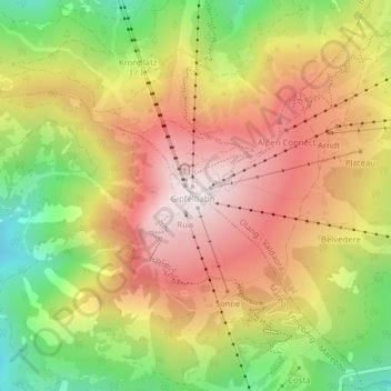
Kronplatz - Plan de Corones topographic map
Interactive map
Click on the map to display elevation.
About this map
Name: Kronplatz - Plan de Corones topographic map, elevation, terrain.
Average elevation: 1,953 m
Minimum elevation: 1,577 m
Maximum elevation: 2,273 m
The Kronplatz (Ladin and Italian: Plan de Corones) is a mountain of the Dolomites in South Tyrol, northern Italy, with a summit elevation of 2,275 metres (7,464 ft) above sea level.
Other topographic maps
Click on a map to view its topography, its elevation and its terrain.
Reischach - Riscone
Italy > Trentino-Alto Adige/Südtirol > South Tyrol > Bruneck - Brunico
Reischach - Riscone, Bruneck - Brunico, Pustertal - Val Pusteria, South Tyrol, Trentino-Alto Adige/Südtirol, 39031, Italy
Average elevation: 1,022 m