
Island topographic map
Interactive map
Click on the map to display elevation.
About this map
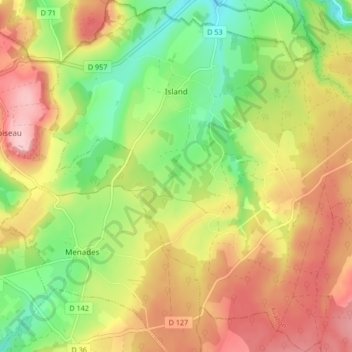
Name: Island topographic map, elevation, terrain.
Average elevation: 255 m
Minimum elevation: 168 m
Maximum elevation: 344 m
Artificial islands are sometimes built on pre-existing "low-tide elevation," a naturally formed area of land which is surrounded by and above water at low tide but submerged at high tide. Legally these are not islands and have no territorial sea of their own.