Geolocate

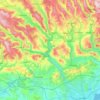
Porth topographic map

Click on the map to display elevation.

About this map
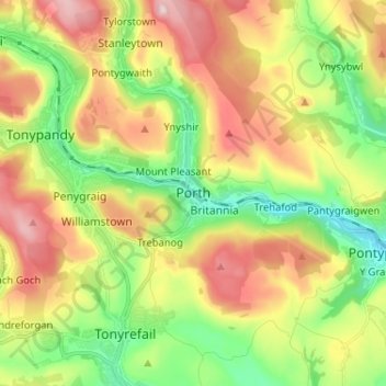
Name: Porth topographic map, elevation, terrain.

Location: Porth, Rhondda Cynon Taf, Wales, CF39 9ST, United Kingdom (51.57259 -3.44859 51.65259 -3.36859)

Average elevation: 226 m

Minimum elevation: 61 m

Maximum elevation: 442 m

Rhondda Cynon Taf trails, hiking, mountain biking, running and outdoor activities

Other topographic maps

Click on a map to view its topography, its elevation and its terrain.
Pontypridd

United Kingdom > Wales > Rhondda Cynon Taf

Average elevation: 183 m

Trealaw

United Kingdom > Wales > Rhondda Cynon Taf > Tonypandy

Average elevation: 222 m

Mid Glamorgan

United Kingdom > Wales > Rhondda Cynon Taf

Average elevation: 235 m

Llyn Fawr

United Kingdom > Wales > Rhondda Cynon Taf > Rhigos

Average elevation: 434 m

Pontypridd

United Kingdom > Wales > Rhondda Cynon Taf

Average elevation: 183 m

Penrhiwceiber

United Kingdom > Wales > Rhondda Cynon Taf

Average elevation: 229 m

Gear up for your next adventure:

📱Rugged Phone Cases - Heavy-duty protection for smartphones used as secondary GPS tools
📱Phone Mounts for Hiking - Secure mounts to carry your phone on trails
🧤Waterproof Overmitts - Extreme weather protection for hikers and mountaineers
🧢Hiking Hats - Sun and weather protection for outdoor walks
🌦️Portable Weather Meters - Handheld tools for monitoring weather conditions

As an Amazon Associate, this site earns from qualifying purchases at no extra cost to you.