
Thank you for supporting this site ❤️
Make a donation
Make a donation
Gear up for your next adventure:
As an Amazon Associate, this site earns from qualifying purchases at no extra cost to you.
Herhet topographic map
Click on the map to display elevation.
Thank you for supporting this site ❤️
Make a donation
Make a donation
Gear up for your next adventure:
As an Amazon Associate, this site earns from qualifying purchases at no extra cost to you.
About this map
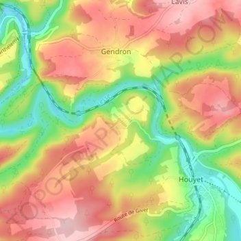
Name: Herhet topographic map, elevation, terrain.
Location: Herhet, Gendron, Houyet, Dinant, Namur, Wallonie, 5561, Belgique (50.17665 4.96845 50.21665 5.00845)
Average elevation: 196 m
Minimum elevation: 104 m
Maximum elevation: 277 m
Thank you for supporting this site ❤️
Make a donation
Make a donation
Gear up for your next adventure:
As an Amazon Associate, this site earns from qualifying purchases at no extra cost to you.