
Thank you for supporting this site ❤️
Make a donation
Make a donation
Gear up for your next adventure:
As an Amazon Associate, this site earns from qualifying purchases at no extra cost to you.
Aannaya topographic map
Click on the map to display elevation.
Thank you for supporting this site ❤️
Make a donation
Make a donation
Gear up for your next adventure:
As an Amazon Associate, this site earns from qualifying purchases at no extra cost to you.
About this map
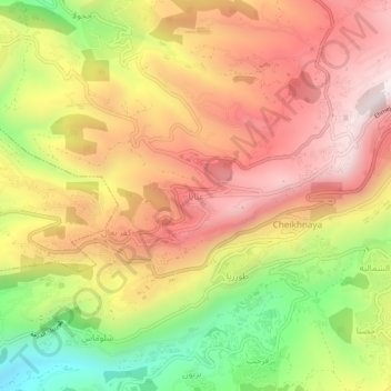
Name: Aannaya topographic map, elevation, terrain.
Location: Aannaya, Jbeil District, Keserwan-Jbeil Governorate, Lebanon (34.09714 35.73468 34.13714 35.77468)
Average elevation: 998 m
Minimum elevation: 527 m
Maximum elevation: 1,363 m
Thank you for supporting this site ❤️
Make a donation
Make a donation
Gear up for your next adventure:
As an Amazon Associate, this site earns from qualifying purchases at no extra cost to you.