
Thank you for supporting this site ❤️
Make a donation
Make a donation
Gear up for your next adventure:
As an Amazon Associate, this site earns from qualifying purchases at no extra cost to you.
Laraqueri topographic map
Click on the map to display elevation.
Thank you for supporting this site ❤️
Make a donation
Make a donation
Gear up for your next adventure:
As an Amazon Associate, this site earns from qualifying purchases at no extra cost to you.
About this map
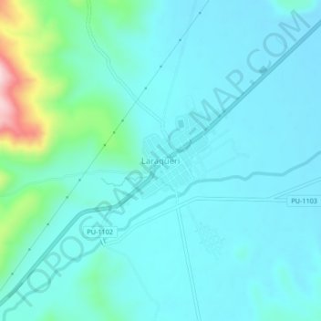
Name: Laraqueri topographic map, elevation, terrain.
Location: Laraqueri, Pichacani, Province of Puno, Puno, Peru (-16.16972 -70.08359 -16.12972 -70.04359)
Average elevation: 3,973 m
Minimum elevation: 3,926 m
Maximum elevation: 4,237 m
Thank you for supporting this site ❤️
Make a donation
Make a donation
Gear up for your next adventure:
As an Amazon Associate, this site earns from qualifying purchases at no extra cost to you.