
Kampung Seberang topographic map
Interactive map
Click on the map to display elevation.
About this map
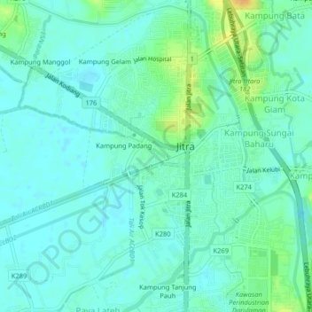
Name: Kampung Seberang topographic map, elevation, terrain.
Location: Kampung Seberang, Jitra, Kubang Pasu, Kedah, 06000, Malaysia (6.24540 100.39598 6.28540 100.43598)
Average elevation: 9 m
Minimum elevation: 1 m
Maximum elevation: 31 m