Geolocate

Red Hill topographic map

Click on the map to display elevation.

About this map

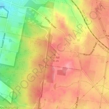
Name: Red Hill topographic map, elevation, terrain.

Location: Red Hill, Ballarat, City of Ballarat, Victoria, Australia (-37.57986 143.90754 -37.57976 143.90764)

Average elevation: 514 m

Minimum elevation: 449 m

Maximum elevation: 554 m

Other topographic maps

Click on a map to view its topography, its elevation and its terrain.

Chisholm Street Reserve

Australia > Victoria > Ballarat

Average elevation: 463 m

Alfredton

Australia > Victoria > Ballarat

Average elevation: 450 m

Sebastopol

Australia > Victoria > Ballarat

Average elevation: 414 m

Ballarat East

Australia > Victoria > Ballarat

Average elevation: 477 m

Mount Rowan

Australia > Victoria > Ballarat

Average elevation: 454 m

Kirks Reservoir

Australia > Victoria > Ballarat

Average elevation: 536 m

Magpie

Australia > Victoria > Ballarat

Average elevation: 408 m

Lake Wendouree

Australia > Victoria > Ballarat

Average elevation: 452 m

Gear up for your next adventure:

🛰️Outdoor GPS Navigation - Navigation devices for remote and off-grid areas
🐕Hiking Dog Harnesses - Rugged harnesses for taking your companion on mountain trails
🧦Hiking Socks - Breathable socks designed to prevent blisters on long walks
👕Merino Base Layers - Natural temperature regulation for cold weather hiking and camping
🎒Hiking Daypacks (20L) - Compact backpacks for day trips and technical mountain ascents

As an Amazon Associate, this site earns from qualifying purchases at no extra cost to you.