
Make a donation
Gear up for your next adventure:
As an Amazon Associate, this site earns from qualifying purchases at no extra cost to you.
Karkonosze topographic map
Click on the map to display elevation.
Make a donation
Gear up for your next adventure:
As an Amazon Associate, this site earns from qualifying purchases at no extra cost to you.
Karkonosze
The Giant Mountains, Krkonoše, or Karkonosze (Czech: [ˈkr̩konoʃɛ] , Polish pronunciation: [karkɔˈnɔʂɛ] , German: Riesengebirge pronounced [ˈʁiːzn̩ɡəˌbɪʁɡə] ), are a mountain range located in the north of the Czech Republic and the south-west of Poland, part of the Sudetes mountain system (part of the Bohemian Massif). The Czech–Polish border, which divides the historic regions of Bohemia and Silesia, runs along the main ridge. The highest peak, Sněžka (Polish: Śnieżka), is the Czech Republic's highest natural point with an elevation of 1,603 metres (5,259 ft).
Make a donation
Gear up for your next adventure:
As an Amazon Associate, this site earns from qualifying purchases at no extra cost to you.
About this map
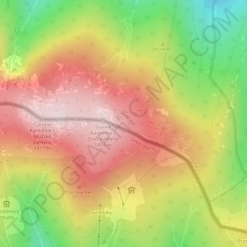
Name: Karkonosze topographic map, elevation, terrain.
Location: Karkonosze, Jelenia Góra, Lower Silesian Voivodeship, Poland (50.77640 15.60522 50.77650 15.60532)
Average elevation: 1,196 m
Minimum elevation: 937 m
Maximum elevation: 1,405 m
Make a donation
Gear up for your next adventure:
As an Amazon Associate, this site earns from qualifying purchases at no extra cost to you.
Other topographic maps
Click on a map to view its topography, its elevation and its terrain.