
Make a donation
Gear up for your next adventure:
As an Amazon Associate, this site earns from qualifying purchases at no extra cost to you.
Schloss Schnaditz topographic map
Click on the map to display elevation.
Make a donation
Gear up for your next adventure:
As an Amazon Associate, this site earns from qualifying purchases at no extra cost to you.
Schloss Schnaditz
Seit der Wende stand das Gebäude leer. Mit der Eingemeindung von Schnaditz nach Bad Düben ist das Schloss 1999 in den Besitz der Stadt Bad Düben gekommen. In den Jahren von 1991 bis 2006 hat die Stadt von der Denkmalschutzbehörde des damaligen Regierungspräsidiums Leipzig für die Pflege des Kulturdenkmals Zuwendungen in Höhe von 651.000 Euro gewährt bekommen.
Make a donation
Gear up for your next adventure:
As an Amazon Associate, this site earns from qualifying purchases at no extra cost to you.
About this map
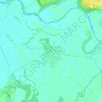
Name: Schloss Schnaditz topographic map, elevation, terrain.
Average elevation: 87 m
Minimum elevation: 82 m
Maximum elevation: 103 m
Make a donation
Gear up for your next adventure:
As an Amazon Associate, this site earns from qualifying purchases at no extra cost to you.