
Thank you for supporting this site ❤️
Make a donation
Make a donation
Gear up for your next adventure:
As an Amazon Associate, this site earns from qualifying purchases at no extra cost to you.
Casaleggio topographic map
Click on the map to display elevation.
Thank you for supporting this site ❤️
Make a donation
Make a donation
Gear up for your next adventure:
As an Amazon Associate, this site earns from qualifying purchases at no extra cost to you.
About this map
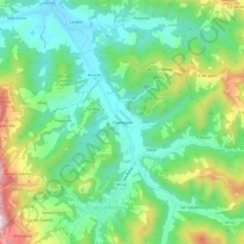
Name: Casaleggio topographic map, elevation, terrain.
Location: Casaleggio, Garbagna, Alessandria, Piemonte, Italia (44.77431 8.98040 44.81431 9.02040)
Average elevation: 347 m
Minimum elevation: 226 m
Maximum elevation: 597 m
Thank you for supporting this site ❤️
Make a donation
Make a donation
Gear up for your next adventure:
As an Amazon Associate, this site earns from qualifying purchases at no extra cost to you.