
Bergeval topographic map
Interactive map
Click on the map to display elevation.
About this map
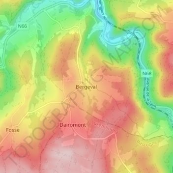
Name: Bergeval topographic map, elevation, terrain.
Location: Bergeval, Trois-Ponts, Verviers, Liège, Wallonie, 4980, Belgique (50.33101 5.84785 50.37101 5.88785)
Average elevation: 395 m
Minimum elevation: 250 m
Maximum elevation: 525 m