
Langnau am Albis topographic map
Interactive map
Click on the map to display elevation.
About this map
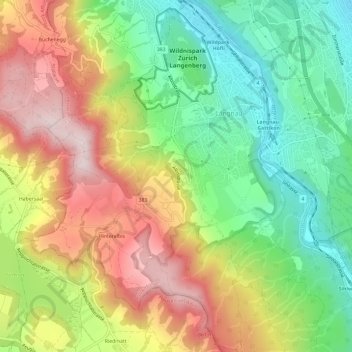
Name: Langnau am Albis topographic map, elevation, terrain.
Location: Langnau am Albis, Bezirk Horgen, Zurich, 8135, Switzerland (47.26031 8.50387 47.30055 8.55223)
Average elevation: 616 m
Minimum elevation: 402 m
Maximum elevation: 890 m
Other topographic maps
Click on a map to view its topography, its elevation and its terrain.
Hinteralbis
Switzerland > Zurich > Bezirk Horgen > Langnau am Albis
Hinteralbis, Langnau am Albis, Bezirk Horgen, Zurich, 8135, Switzerland
Average elevation: 688 m