
Makarachal topographic map
Interactive map
Click on the map to display elevation.
About this map
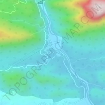
Name: Makarachal topographic map, elevation, terrain.
Location: Makarachal, Kothamangalam, Ernakulam district, Kerala, India (10.18248 76.69107 10.22248 76.73107)
Average elevation: 208 m
Minimum elevation: 38 m
Maximum elevation: 924 m