Geolocate

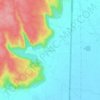
Sohna topographic map

Click on the map to display elevation.

About this map

Name: Sohna topographic map, elevation, terrain.

Location: Sohna, Gurugram, Haryana, 122102, India (28.20057 77.00314 28.44658 77.24187)

Average elevation: 242 m

Minimum elevation: 191 m

Maximum elevation: 342 m

Other topographic maps

Click on a map to view its topography, its elevation and its terrain.
Sohna

India > Haryana > Gurugram

Average elevation: 229 m

Ghamroj

India > Haryana > Gurugram

Average elevation: 245 m

Gear up for your next adventure:

📱Rugged Phone Cases - Heavy-duty protection for smartphones used as secondary GPS tools
🗺️Scratch-off Peak Maps - Track your progress climbing Munros or Wainwrights
🧗Locking Carabiners - Secure gear to your pack or for light technical use
🖼️Topographic Map Art - Decorative 3D-effect posters of famous UK peaks and regions
🔦Waterproof LED Headlamps - Hands-free lighting for evening treks and emergency navigation

As an Amazon Associate, this site earns from qualifying purchases at no extra cost to you.